

Tierfed

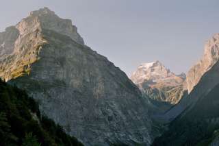
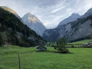
At the foot of the Tödi - between imposing rock faces - fabulously remote.
The Tierfed in Linthal is located at the foot of the Tödi. For some "z hinderscht" in the canton, and for others "z vorderscht" – as a beginning. One thing is certain: The Tierfed is not only the starting point for the ascent of the highest Glarner via Fridolinshütte, but also for further hikes and surprises with a handful of sights:
Hotel Tödi – fabulously remote
At the back of the Glarus region, between steeply towering mountains, where the view can only glide unhindered out of the valley, stands the legendary Hotel Tödi. Those who get lost here either have their good reasons or are simply lucky.
Old meets new: The Hotel Tödi was expanded and rebuilt in 2008-2009 and has been shining in new splendour ever since. What attracted hikers and mountaineers, connoisseurs and philosophers from all over the world a good 140 years ago has come back to life at the Hotel Tödi.
Power plant tour of the Limmern pumped storage plant
It's hard to believe that in these mighty rock faces up to the Muttsee there is a state-of-the-art pumped storage plant in the mountain. This can be explored on a tour.
hoteltoedi.ch/fileadmin/Dateien/Dateien/1902_Flyer_Erlebnis-Strom.pdf
Tierfed-Chalchtrittli cable car
The modern cable car climbs 1000 metres in altitude from the Tierfed to the Chalchtrittli within a few minutes and from there allows you to hike to the Muttseehütte SAC and the Muttsee dam behind it.
Mountaineering to the highest Glarus hut or to the highest SAC hut in Eastern Switzerland
From Tierfed, you can take the Alpentaxi Vollenweider (+ 41 79 770 34 86) to Hintersand. From there it goes up to the Fridolinshütte or the Planurahütte, the highest SAC hut in Eastern Switzerland (2947 m.a.s.l.) at the Clariden/Hüfifirn with the largest wind pool in Europe.
Other exciting summit destinations or hikes can be tackled from Tierfed or Hintersand.
Schreyenbach Falls
The Schreyenbach Falls used to be a natural attraction known throughout Switzerland. Since 1964, with the commissioning of the Linth-Limmern power plant, it has fallen silent. One catchment literally dug the water out of him. The water of the Fisetenbach, which rises in the canton of Uri and feeds the Schreyenbach Falls, is collected for the purpose of electricity production, i.e. withheld from the Schreyenbach Falls. However, after objections, the natural spectacle can still be followed 45 days a year.
The following dates are scheduled for the discharge of the Fisetenbach and Wildwüestibach catchments:
Start: June 18 2:00 p.m.
End: August 2 2:00 p.m.
Linth Gorge, "Känzeli" and Pantenbrugg
The 1.4 km long Linth Gorge begins at the confluence of the Sandbach and Limmernbach at 1050 m and ends in the Tierfed at 810 m. From Tierfed/Linthal, an approx. 30-minute hiking trail leads to the famous Pantenbrücke. Shortly before the tunnel, a path leads down to the left to the viewing platform. Here you can enjoy a view of the imposing gorge and the Panten Bridge at lofty heights. The bridge, built between the almost vertical rock faces, is the only crossing over the Linth Gorge on the way to the Kisten- and Sandpass and once served as an important crossing into Graubünden.
The "Känzeli" is also a viewing platform, which can be reached in a walk from the Hotel Tödi. To get to Känzeli, follow the path along the Linth (past the water basin, do not follow the path to Pantenbrugg) to the forest, where a signpost points up to the Känzeli.
By the way:
The book "The Giant in the Tree" and later the children's book "The Giant Melchior" by Eveline Hasler is about Melchior Thut from the Tierfed (11.01.1736 - 03.08.1784), who at that time traveled around with a height of 2.31m as the tallest Swiss in Europe to show himself dressed in a Swiss mercenary uniform for money. Later he worked as a servant at the court of Duke Karl Eugen of Württemberg.
Hotel Tödi – fabulously remote
At the back of the Glarus region, between steeply towering mountains, where the view can only glide unhindered out of the valley, stands the legendary Hotel Tödi. Those who get lost here either have their good reasons or are simply lucky.
Old meets new: The Hotel Tödi was expanded and rebuilt in 2008-2009 and has been shining in new splendour ever since. What attracted hikers and mountaineers, connoisseurs and philosophers from all over the world a good 140 years ago has come back to life at the Hotel Tödi.
Power plant tour of the Limmern pumped storage plant
It's hard to believe that in these mighty rock faces up to the Muttsee there is a state-of-the-art pumped storage plant in the mountain. This can be explored on a tour.
hoteltoedi.ch/fileadmin/Dateien/Dateien/1902_Flyer_Erlebnis-Strom.pdf
Tierfed-Chalchtrittli cable car
The modern cable car climbs 1000 metres in altitude from the Tierfed to the Chalchtrittli within a few minutes and from there allows you to hike to the Muttseehütte SAC and the Muttsee dam behind it.
Mountaineering to the highest Glarus hut or to the highest SAC hut in Eastern Switzerland
From Tierfed, you can take the Alpentaxi Vollenweider (+ 41 79 770 34 86) to Hintersand. From there it goes up to the Fridolinshütte or the Planurahütte, the highest SAC hut in Eastern Switzerland (2947 m.a.s.l.) at the Clariden/Hüfifirn with the largest wind pool in Europe.
Other exciting summit destinations or hikes can be tackled from Tierfed or Hintersand.
Schreyenbach Falls
The Schreyenbach Falls used to be a natural attraction known throughout Switzerland. Since 1964, with the commissioning of the Linth-Limmern power plant, it has fallen silent. One catchment literally dug the water out of him. The water of the Fisetenbach, which rises in the canton of Uri and feeds the Schreyenbach Falls, is collected for the purpose of electricity production, i.e. withheld from the Schreyenbach Falls. However, after objections, the natural spectacle can still be followed 45 days a year.
The following dates are scheduled for the discharge of the Fisetenbach and Wildwüestibach catchments:
Start: June 18 2:00 p.m.
End: August 2 2:00 p.m.
Linth Gorge, "Känzeli" and Pantenbrugg
The 1.4 km long Linth Gorge begins at the confluence of the Sandbach and Limmernbach at 1050 m and ends in the Tierfed at 810 m. From Tierfed/Linthal, an approx. 30-minute hiking trail leads to the famous Pantenbrücke. Shortly before the tunnel, a path leads down to the left to the viewing platform. Here you can enjoy a view of the imposing gorge and the Panten Bridge at lofty heights. The bridge, built between the almost vertical rock faces, is the only crossing over the Linth Gorge on the way to the Kisten- and Sandpass and once served as an important crossing into Graubünden.
The "Känzeli" is also a viewing platform, which can be reached in a walk from the Hotel Tödi. To get to Känzeli, follow the path along the Linth (past the water basin, do not follow the path to Pantenbrugg) to the forest, where a signpost points up to the Känzeli.
By the way:
The book "The Giant in the Tree" and later the children's book "The Giant Melchior" by Eveline Hasler is about Melchior Thut from the Tierfed (11.01.1736 - 03.08.1784), who at that time traveled around with a height of 2.31m as the tallest Swiss in Europe to show himself dressed in a Swiss mercenary uniform for money. Later he worked as a servant at the court of Duke Karl Eugen of Württemberg.
Price information


Event date
Address
Auenstrasse
8783
Linthal
Contact




Verantwortlich für diesen Inhalt: VISIT Glarnerland AG
Fehler melden (ID: civ_s9t_ggsivttf-rdhv-egss-rfcb-rdrrtrsqhrtr)
Fehler melden (ID: civ_s9t_ggsivttf-rdhv-egss-rfcb-rdrrtrsqhrtr)